
Sierra Leone
Sierra Leone has a tropical climate, typified by warm temperatures and high humidity. Night time temperatures rarely drop below 24 °C and daytime temperatures reach 30 °C throughout the year. From October to March…
At a glance
Useful facts for planning
In this guide
Why go
Overview
Sierra Leone has a tropical climate, typified by warm temperatures and high humidity. Night time temperatures rarely drop below 24 °C and daytime temperatures reach 30 °C throughout the year. From October to March the weather is generally dry with many fine, hot, sunny days. From April to September is the rainy season. The rainfall increases to a peak in July and August and then decreases until rain has almost ceased by November.
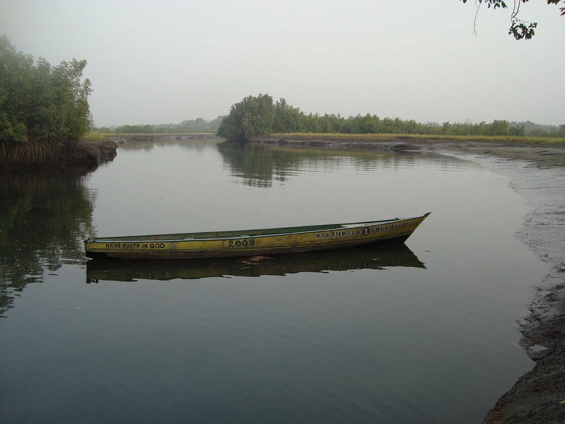
The country has a coastal belt of mangrove swamps with wooded hill country, upland plateau and mountains in the east. The highest point is Loma Mansa (Bintimani) at 1,948 m. It has 402 km (250 mi) of coastline.
From an approximate coastal belt 100 km (62 mi) long of low-lying land, the country rises to a mountain plateau near the eastern frontier rising 1,200 m (3,900 ft) to 2,000 m (6,600 ft) with an important timber forest region.
The peninsula, on which the capital and main commercial centre of Freetown stands, is 40 km (25 mi) long and 17 km (11 mi) wide with a mountainous interior.
Culture and food
The main staple of Sierra Leonean food is rice, often accompanied by soup, i.e., stews. These stews may include a delicious and often spicy mix of meat, fish, seasonings, greens, etc., often taking hours to prepare. There are plenty of good quality restaurants offering a variety of local and international dishes.
The diet of Sierra Leoneans like many African countries is very healthy. Many tend to eat some fresh fruit picked from trees growing in their homes or freshly picked by market vendors that very day. They also eat seafood particularly in the capital Freetown which is on the Atlantic coast. It is common to go to areas such as Lumley Beach where one can find local fishermen pulling in nets from the Atlantic filled with fish such as crabs, lobsters, oysters, snappers and many, many more.
The national brewer Sierra Leone Breweries Limited produces Star beer and the premium Mützig beer. Star is available in small and large 60 cl bottles. Many European beers are imported. As in many African countries Guinness is widely popular. Soft drinks such as Coca Cola and Fanta are locally produced. Wine is available from restaurants and supermarkets, but can be expensive. Local brewed palm wine (called "poyo" in Krio), is very popular throughout Sierra Leone. Beware of spirits (whisky, gin, etc.) which are sold in large plastic containers, as their quality and safety are uncertain.
Rice is the staple food of Sierra Leone and is consumed at virtually every meal. The rice is prepared in numerous ways, and topped with a variety of sauces made from some of Sierra Leone's favourite toppings, including potato leaves, cassava leaves, crain crain , okra soup, fried fish and groundnut stew.
Along the streets of towns and cities across Sierra Leone, one can find foods consisting of fruit, vegetables and snacks such as fresh mangoes , oranges, pineapple, fried plantains , ginger beer , fried potato, fried cassava with pepper sauce; bags of popcorn or peanuts, bread, roasted corn, or skewers of grilled meat or shrimp.
Media in Sierra Leone began with the introduction of the first printing press in Africa at the start of the 19th century. A strong free journalistic tradition developed with the creation of several newspapers. In the 1860s, the country became a journalist hub for Africa. At the end of the 19th century, the industry went into decline, and when radio was introduced in the 1930s, it became the primary communication medium in the country.
Sights and landscapes
Sierra Leone is on the southwest coast of West Africa , mostly between latitudes 7° and 10°N (a small area is south of 7°), and longitudes 10° and 14°W . It is bordered by Guinea to the north and east, Liberia to the southeast, and the Atlantic Ocean to the west and southwest. It has an area of 73,252 km 2 (28,283 sq mi), divided into a land area of 73,132 km 2 (28,236 sq mi) and water of 120 km 2 (46 sq mi).
In eastern Sierra Leone the plateau is interspersed with high mountains, where Mount Bintumani reaches 1,948 m (6,391 ft), the highest point in the country. The upper part of the drainage basin of the Moa River is in the south of this region.
The centre of the country is a region of lowland plains , containing forests, bush and farmland , that occupies about 43% of Sierra Leone's land area. The northern section of this has been categorised by the World Wildlife Fund as part of the Guinean forest-savannah mosaic ecoregion , while the south is rain-forested plains and farmland.
In the west, Sierra Leone has 400 km (249 mi) of Atlantic coastline, giving it both bountiful marine resources and attractive tourist potential. The coast has areas of low-lying Guinean mangroves swamp. Freetown sits on a mountainous coastal peninsula next to the Sierra Leone Harbour.
The climate is tropical, with two seasons determining the agricultural cycle: the rainy season from May to November, and a dry season from December to May, which includes harmattan , when cool, dry winds blow in off the Sahara Desert and the nighttime temperature can be as low as 16 °C (60.8 °F). The average temperature is 26 °C (78.8 °F) and varies from around 26 to 36 °C (78.8 to 96.8 °F) during the year.
Travel guide text compiled and adapted from Wikivoyage article (contributors) and Wikipedia article (contributors). Sections were selected and reordered for this guide. Text is shared under CC BY-SA 4.0. Check current arrangements with your travel consultant.
Plan the full journey
Useful for this trip
This country’s visa guidance has not been fully verified against current official requirements. Confirm the application route for your passport, residence and purpose before making travel commitments.
Review details
Sierra Leone: The supplied sources could not provide sufficient readable official guidance during this assessment. 1 source link(s) could not be retrieved successfully; see the source log. Still to confirm: passport validity, tourist and business eligibility, application route, any exemptions and published processing guidance. Residents using other passports require a separate nationality check.